An essential part of any adventure or location supplement is its map. It doesn’t matter how carefully the designer’s crafts the text, if the map is crap.
Luckily, a crap map is something City Backdrop: Languard will not be forced to endure! A couple of weeks ago, Tommi Salama turned over a gorgeous city map for the project. I’m particularly lucky to have Tommi onboard with the project because he is patient with my questions and comments and doesn’t mind my many minor revisions. He is also—obviously—an epic-level mapper.
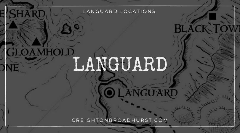
Anyway, I thought you might like to see the map ahead of the project’s release at the end of February. Behold Languard in all its glory!

A Note About the Key
I’ve designed the location keys to be easily expandable in the future so I can easily add more locations. Thus:
- F: A location in the Fishshambles.
- G: One of Languard’s gate.
- H: A location in High City.
- L: A location in Low City.
- S: A location in the Shambles.
- T: One of Languard’s temples.
- W: A location in the Wrecks.
Low City Locations
- G1 Low Gate: Low Gate is always busy, choked with a multitude of carts piled high with trade goods.
- G3 Traitor’s Gate: “Decorated” with the remains of traitors to the crown, Traitor’s Gate is well named.
- L1 Low Market: A bustling market fills this muddy space.
- L2 Vonya’s Span: Of dwarven craft—and reputedly haunted—Vonya’s Span is the only bridge spanning the Svart.
- L3 The Scythe: The one-legged Arvo Outila runs this drinking den renown for live music.
- T1 Fane of the Waves Eternal: Here Serat’s worshippers commune with the ocean’s eternal glory.
Fishshambles Locations
- F1 The House of Sighs: Seeking shelter in this almshouse is little better than living on the streets.
- F2 The Drunken Sailor: A popular dockside tavern.
Shambles Locations
- S1 Raisa’s Curios: Idle adventurers often come here to browse the eclectic range of goods on offer.
- S2 The Bloody Eagle: A seemingly destitute merchants runs this tavern, which is a Shadow Mask front.
Wrecks Locations
- W1 Duranki’s: The Duranki family will ferry (unwary, too-trusting) adventurers to Gloamhold, for a fee.
- W2 The Fallen Maid: Here dwells one of Ashlar’s pre-eminent assassins.
High City Locations
- G2 River Gate: These two towers oversee all river traffic.
- G4 Duke’s Gate: The least-used of Languard’s gates. Only those travelling northwards use this gate.
- H1 Castle Languard: Family Nenonen’s seat.
- H2 High Market: Those with a taste for the finer things in life come to High Market.
- H3 Urmas’ House: The aged sage Urmas—one of Ashlar’s greatest authorities on Gloamhold—dwells here.
- H4 The Dreaming Spires: Ashlar’s centre of learning, the library here is only matched by that held at the Black Tower.
- T2 The Father’s Hall: A cathedral dedicated to Conn’s worship and the centre of his faith in Ashlar.
- T3 The Great Forge: A clamour of noise and smoke perpetually rises above Abarin’s temple-forge.
- T4 Watcher’s Spire: Darlen’s followers dwell in this fortified temple.
Languard
Languard is the capital city of Ashlar and closest settlement of note to Gloamhold’s benighted halls.
City Backdrop: Languard releases on 25 February in Pathfinder, 5e and System Neutral editions. Members of Raging Swan’s Patreon campaign get all three versions of the city for only $5!
Not bad, fairly traditional but seems to have an awful lot of empty space for a medieval city. If my research for my own game is accurate, the typical medieval city had about 40,000 people / sq mile. Modern day San Francisco for example has about 17K / sq mile.
And like a medieval city, modern day San Francisco also has people pooping in the street…
I would imagine that most of the buildings in the Shambles, the Fishshambles, and to a lesser extent even the Low City are multi-story tenements packed with the unwashed and disease-ridden masses, which would up the population density on the southern shore of the river quite a bit. This could be verified by counting structures and dividing into population, but I’m lazy.
Also, medieval city builders had no magic available to aid in construction, didn’t face occasional threats from creatures that were taller than the walls or could fly, and had very minimal knowledge of disease vectors. Perhaps the High City was built on lessons learned from the Low and/or incorporates a land ownership model very different from the Middle Ages. And the unusually well-developed fortifications could be a magically-assisted response to the fantasy threat level. It’s also possible that Clan Nenonen is filthy rich thanks to their long-ago Gloamhold delve and prefer a more open city in a nod to their elven heritage.
As fantasy art, the map is beautiful. My only complaint would be a lack of contour – I’m pretty sure the city isn’t flat. But I seem to recall Creighton describing the slope of the city in the text somewhere.
Creighton, please consider a label-free version (perhaps as an online download?) so we have something to put on the table for our players to see!
I have free tagged and untagged versions of the map available on the book’s webpage. Follow the link below and scroll down to the bottom:
http://www.ragingswan.com/city-backdrop-languard/
There is certainly a lot of empty space in High City–that’s by design as the people there are posh. In Low City and its attendant areas, though, the city is a tangled mess!
Oh the many adventures that could be had in a city such as this! Great design and amazing graphics work. You and your team continue to impress!
I’d definitely say it’s a map worthy of the effort you’re putting into this setting. Great work, Tommi!
Visually excellent – a very creative layout.
My critique though – the city is effectively cut into 2 with only 1 single bridge connecting it and it is an extremely long way around by road from the SW area to the NW. If main traffic is coming through the gate at G1 – there’s a lot of goods to be taken to the North side where the temple and castle are located. The bridge at L2 would have unholy traffic jams – would a city really evolve like this?
I’d suggest describing that bridge at L2 as a 6 lane mega-bridge, one of the engineering wonders of the kingdom. If the river current wasn’t too severe, ferries and barges could work between the 2 sides of the city. Personally though, I would add another bridge across the river mouth between T1 and H2 to close the loop.
Just my 2 shillings.
Cutting the city is half was actually party of my conscious design. I think the wealthy in High City would want to stay away from the stink of the Low City and wouldn’t be too keen on riff-raff wandering their “nice” streets.
As I see it, and as you suggest, there would be a ton of river traffic going backwards and forwards carrying goods and so on.
You are absolutely right, though, the Vonya’s Span would be one of the busiest thoroughfares in the city!
The artwork and cartography on this piece is excellent.
But looking at this from a “how the city developed” point of view … it should probably have developed from perhaps two original smaller towns – one at the mouth of the harbor on the west and one at the river mouth on the east. Then those two cities would have grown to meet each other, so there would still be traces of concentric roads around those two points. There should be much more development around the bridge and along the riverbanks. There should also be a major concentration of warehouses and piers near the harbor mouth on both sides of the harbor where goods intended for the western side could be landed – shipping the length of the harbor would be faster and more efficient than going by road through the city.
Unless the oceanfront is actual cliffs, there should be a lot of development along the sea’s edge, with entrances where the people living along the shore can get into the city in case of attack from the water. If the oceanfront is actual cliffs, the elaborate walls and forts could be replaced with simpler fortifications since the cliffs themselves serve as fortifications, and the larger forts placed around the eastern edge at the various gates, especially at the River Gate, which should be the most heavily-defended area.
Excellent! I’m really enjoying watching this setting get fleshed out.
I’ll be buying this one!
Thank you, John! I hope you enjoy it.
I have been following your Gloamhold setting for a long time, and I love it and this map is a perfect fit. Detailed, but with just enough room for a DM to put in his own flavor. Really good stuff here, Keep it up and eventually you will able to afford a new caricature for your profile pic. 🙂
Fantastic map- thank you!